Sheltowee Trace Trail and Van Hook Falls
For months now, I have dreamed of packing up the family and going to Kentucky for an amazing hike. I grew up spending summers in Kentucky, but we mostly traversed the waterways via boat, and played euchre by the light of lanterns around a campsite with 75 of our closest relatives. Never once do I remember hiking, but I do have a very strong connection to that area and couldn't wait to explore the forests that are so familiar from the perimeter. In fact, when we settled in Missouri, I frequently said how much it reminded me of Kentucky. And guess what! Daniel Boone thought the same thing when he passed through Missouri. It reminded him of the forests of Kentucky too, which is why we have forests named after him as well.


So anyway, months ago, I started looking for a trail that we could hike over Memorial Day weekend, when we would have time to travel to Kentucky. I started pinning ideas to a Pinterest board for Kentucky trails and almost immediately was drawn to this trail to Van Hook Falls. The website boasts about the multiple waterfalls and creek beds and is moderate terrain and length. Perfect for our hiking family. I dug deeper and found that the trail head was actually just about 15 minutes from where our family stays! This was perfect.
So off we drove to Kentucky, an 8 hour drive in all. It's nice because it's a different route than we take to Ohio, and I love seeing different parts of the country. The fields of Indiana and Illinois are so restful, and I love driving over rivers. On this trip, we drove over the Mississippi, Missouri, and Ohio Rivers.
As for hike preparation, this write-up of the trail by Jeremy Patton was perfect for out of state people like us. We knew exactly what to expect and what to look for along the trail. The All Trails site was also helpful, particularly because the comments were spot on. The most helpful comment said to bring swimming clothes (which we did), and hiking boots (which I didn't - and totally regretted). Let that be a lesson to us all.
So off we went into the woods, thick with green, and all downhill.
But the path was beautifully cleared even when the woods seemed to be closing in on us. I love it when state parks put this much care into trail paths.
Sections of the forest ground were covered in ferns.
Along the way, we crossed several creeks. Around here when we cross creeks, we often have to build our own rock bridges to get across. But on this trail, every single creek had a well constructed, very steady rock bridge already put together. It was so much fun!
"Into the forest I go to lose my mind and find my soul." -John Muir
Just like the web pages said, the first third of the trail is pretty easy, although it is downhill. And since this trail isn't on a loop, you'll be climbing back up that hill at the end of this 5 mile hike.
And before we knew it, we came across the first of several waterfalls. None of the waterfalls were rushing, but I'm glad that they at least weren't all dried up. It was so magical walking through the woods and hearing all the flowing water.
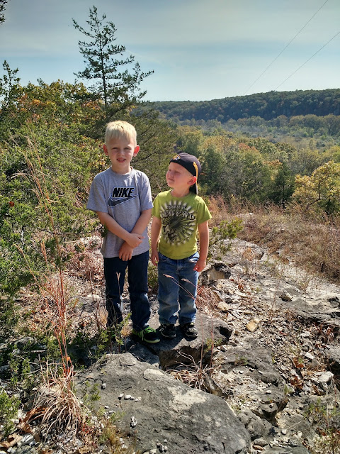
My mom took this hike with us, which meant we had a photographer to get pictures of the whole family for a change! We didn't pass up any photo opportunity.
The second part of this trail became a little more rugged along the trail. There were lots of tree roots and rocks sticking out of the ground which made me really wish I had taken the advice to wear my hiking boots. Ankle support would have made this a little less difficult. We were constantly reminding each other to "look down," and "watch out for..."
But still, just look at this path. It's so inviting, protruding rocks and all.
But still, just look at this path. It's so inviting, protruding rocks and all.
Just a few states away, but some of the vegetation seemed so different from what we have around here.
Rocky staircase up the path.
Love this picture of all these majestic trees, with not much growing underneath them.
Another waterfall and little watering hole where we stopped to play for a while.
About this part of the trail we started passing by rocky overhangs (for lack of a better term) that were also great for exploring.
Another small waterfall.
Jeremy found himself a walking stick, which was so good that he brought it back to Missouri with him.
As we trekked on, the trail went from open...
to dense...
And then even denser. At times, it felt like we were walking through a jungle.
At this point, we were in the final third of the hike which is by far the most difficult. There were some really steep downgrades.
But some really cool places to explore.
By this time, we were starving. Because we explored so much, it took us a really long time to get this far. And also, it was hot, and we were getting tired. But we knew from the trail app that we were really close to the end so we all pushed on.
Right about here, we came across a stream where a lot of people had stopped to play. The boys were really wanting to stop too, but we were 1/10 mile away from the Van Hook Falls - the end of this hike. So we trekked on, with the promise to stop and swim when we passed through.
This bridge looks like it's going into a secret forest.
This bridge looks like it's going into a secret forest.
This last part was one of the trickiest parts of all. We had to climb over and down boulders.
And the boys loved every minute.
And finally, finally, we were there. We saw the Van Hook Falls. It was by far the tallest fall on the trail, and although it was somewhat anti-climatic since you can only view them from afar and there wasn't much water, we were so glad we made it to the end.
One of the best parts was that we were the only ones in the area (everyone else must have been at that swimming spot we passed). There was a bench overlooking the falls which was the perfect spot to stop for lunch which consisted of chicken salad wraps, granola bars, and water. It absolutely hit the spot.
Here's my mom, Jeremy, and Lex resting on the bench. Eli was off exploring.
Here's my mom, Jeremy, and Lex resting on the bench. Eli was off exploring.
There was a spot where you could climb down a little further to get closer to the falls so we checked it out for a while.
And then after we were fed, rested, and changed (Lex and I both changed into shorts while we were here), we headed back. Our hiking app said we had gone 2.58 miles, so that meant we had that far to get back to our car, and most of it would be uphill.
But not before a little swim.
The boys loved sliding down the waterfall.
And then back up, and up, and up for 2.58 miles.
We were exhausted. Our legs and feet were sore, it was hot, and we were all sweating buckets. But we continued, barely stopping for 2.5 miles straight. I was so proud of everyone.
Someone was totally tuckered out. We probably had 1/10 of a mile to go at this point, but it didn't stop him from collapsing in exhaustion.
And finally, we made it back to the trail head, all exhausted... but we did it. 5.16 miles. And we survived to blog about it.
This trail is definitely in the moderate difficulty category. The terrain and inclines, along with the giant boulders at the end are all worth noting. The waterfalls were incredible and would be even better right after a rain (although then the trail would be muddy, so there's that). Even in the heat of the summer (late spring), the shade kept the trail fairly comfortable. My advice is to definitely plan to stop and swim at the end of this trail. It's a great way to refresh yourself before heading back up the trail. Even on this holiday weekend and a parking lot full of cars, the trail was very sparsely populated, which is our favorite kind of trail.
Happy hiking from our family to yours. Hope your summer is full of adventures!
Happy hiking from our family to yours. Hope your summer is full of adventures!
Comments
Post a Comment