Gans Creek Winter Hike
Finally, finally, I can write about hiking again. Which means the cold snap has passed, at least for now. We are creeping out of our state of hibernation. I lie. We are running out of hibernation and heading straight for the woods. Missouri weather has spoiled us the past few years because we have been able to hike straight through the winter. But not this year. When the windchill is below 10, or even 25, we prefer movie watching, game playing, puzzle solving, and staying indoors in general. But watch out when the thermometer peaks above 30, because we are out of here, and on the trail.
My New Years Resolution was all about being outdoors more, so I was sad to watch day after day pass by without logging a single mile on the trail. We've hiked at least partial trails at pretty much every trail system in our county. But there are still loops and connectors within those trail systems that we have yet to venture, so last weekend, we headed back to Gans Creek (Shooting Star Trailhead) to complete another loop.


The boys remembered being here once before when they sent leaves floating down that little stream over the rock. They did it again and again.


My New Years Resolution was all about being outdoors more, so I was sad to watch day after day pass by without logging a single mile on the trail. We've hiked at least partial trails at pretty much every trail system in our county. But there are still loops and connectors within those trail systems that we have yet to venture, so last weekend, we headed back to Gans Creek (Shooting Star Trailhead) to complete another loop.

Christmas brought us all some new hiking gear including these hydration packs for the boys from their grandparents. They absolutely loved having their own water source and we absolutely loved not having to stop every half mile for a water break. The packs are small enough that the boys can manage them without issue, but surprisingly, there is also room for them to carry their own snacks and a couple of other small things (like Eli's new compass).
The other new addition to our hiking game was action cameras for each of the boys. I thought they came with head and chest straps but they didn't, so for this hike, they just each wore them on their wrist. I'll be getting the chest/head straps soon though, because having a camera strapped to your wrist is not conducive to climbing, falling, etc. That being said, the boys absolutely loved recording the hike from their viewpoint. Perhaps on another post, I'll share more about these cameras, but the truth is we haven't even downloaded the videos yet and I don't really know that much about them. It was sweet to watch them narrate the hike though. I can't wait to see what they recorded.
The other new addition to our hiking game was action cameras for each of the boys. I thought they came with head and chest straps but they didn't, so for this hike, they just each wore them on their wrist. I'll be getting the chest/head straps soon though, because having a camera strapped to your wrist is not conducive to climbing, falling, etc. That being said, the boys absolutely loved recording the hike from their viewpoint. Perhaps on another post, I'll share more about these cameras, but the truth is we haven't even downloaded the videos yet and I don't really know that much about them. It was sweet to watch them narrate the hike though. I can't wait to see what they recorded.

As for the trail conditions on this beautiful day, muddy just about sums it up. For nearly half of the hike, we walked on the edge of the trail instead of down the middle, because the mud was deep. I got some new hiking boots for Christmas, and getting them covered with mud was the perfect way to break them in.


Eli took a couple of spills on this hike. Maybe because his feet were covered with mud, or maybe because sometimes he just takes the most difficult path he can take. Little adventurer.

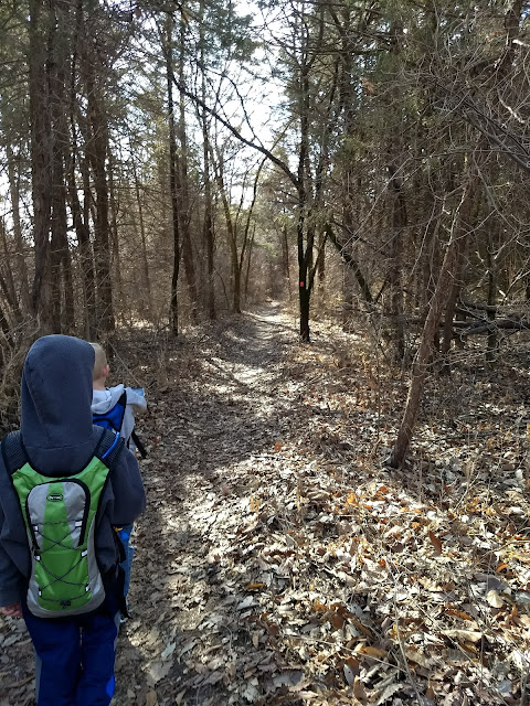
The entire trail has been recently reblazed and it made it so easy to follow! There are trail maps at every trail head and the blaze marks are bright and frequent. We have been known to miss our turn off on the trail system before, but that almost seems impossible now with how clearly they've marked it. The loops are blazed with different colors, and the connectors are marked with white blazes with numbers. The boys lead the way the whole time.

We saw several fallen trees close to the trail. They are really good at maintaining the trail and removing any fallen trees that fall on the trail (or at least a section of the tree).

One of the things we love about this trail is the change in elevation. You can be on the top of the bluff overlooking the creek bed, and then a few minutes later, you're at the creek bed and hiking back up. Here are the boys on the incline.

Looking down over the valley.

The sky...Sigh. We all started shedding layers early on because it was just so nice.


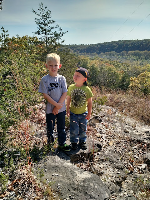
The boys up high on the bluff.

And an incredible Missouri view. One of many reasons we hike. #Missourilove

Overlooking the river. We'll be down there in about 30 minutes.


This actually is a pretty popular trail system, but because it's so expansive, you can go quite a ways without seeing anyone else.


Heading back downhill. The boys with their hydration packs and cameras barely talked to us throughout much of the hike.

Finally, we spotted some water, er, I mean ice. That's a really cool thing about winter hikes. Instead of throwing rocks into the water, we throw rocks at the ice and predict if it will break or not. Even though there was a thin layer of water on the top of the ice, the ice itself was surprisingly thick. We couldn't break it.

But we tried.

More fallen trees. I also wonder what caused it to fall. Lightening? Old age? The wind?

This moss covered rocky ledge was interesting, and somewhat eerie.

Every once in a while, they let me be the leader. So kind. Here are the boys all clearly dodging the muddy trail.

And finally we came to the main creek bed. This rocky path is actually part of the trail, and this part of the trail is actually the convergence of several paths in the trail system. Which means lots of people stop here to rest or play. It looks as if the creek is melted, but under that water is ice thick enough that adults were out walking on it.

The icy creek that was probably completely melted just a few days later.

And then the loop we were completing merged with a path we have hiked before, taking us back up to our car.

With more beautiful overlooks of the creek bed.


This path is one of my favorites. Walking into it feels like you're walking into a different world.


And finally we rounded the corner to the parking lot, where we took off our muddy shoes before climbing into the van.

Here are some stats from Geotracker, although they are a little off. See those gaps in the blue line? That's where we lost cell service, which means the app assumes we stopped hiking. So the final hike was actually a bit longer than what it says here.


First hike of the year is in the books!


Comments
Post a Comment