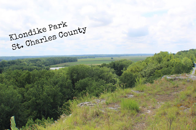
Klondike Park, St. Charles County
Here is a summary of the conversations taking place in our house this summer.
Boys: Can we watch t.v.?
Me: Sure
Boys: Can we play on the Xbox?
Me: Sure
Boys: Can we go on a bike ride?
Me: Sure
Boys: Can we go to the Nature Center?
Me: Sure
Boys: Can we play in the sprinkler?
Me: Sure
You get the point. We aren't checking off any to do lists this summer. In fact, there have been many days that I wake up and think, "Today is the day I will make a to do list," and then the boys ask to go to the park, and I say, "sure." Because that's the kind of summer we all need. Not one that is scheduled from dusk to dawn, and not one that has us all stressing about what we need to get done before tomorrow. It has been lovely I tell you.
We've been on a few local hikes and have been to the creek a few times. We've been to Eagle Bluffs to see the landscape and we watched the sunset over the river. We've chased a few rainbows and we've played in the rain. We recently waited until the boys were in their p.j.s and then surprised them with a sunset trip to the country to a field with a spectacular firefly display. I can't tell you the number of times we've loaded the boys up in the van in their pajamas to go on a nightfall adventure. It's the best.
All that being said, we have been dying to get out on a new trail and have had several locations picked out for quite some time. Summer solstice brought us a reprieve from the heat, which was the perfect reason to spend a day out of town. We had heard that Klondike park had some difficult trails with amazing views. Yes please!


So this trail is also a bike trail. There are actually stunt areas throughout the trail. We were lucky to find that the trail is actually closed to bikers right now. I say lucky, because there are some parts of the trail that are really narrow and have been washed out a little bit, so I would hate to share the trail with bikes. That being said, if you are a cyclist, and are looking for a place to ride and try stunts, then you should keep your eye on this trail for when it opens back up.


Here are the links to both the trail map and the park map. They didn't have any set out in the map holders when we were there, so it might be best to print yourself a copy if you go.
Trail Map, pdf
Park Map, pdf
Until next time!
Boys: Can we watch t.v.?
Me: Sure
Boys: Can we play on the Xbox?
Me: Sure
Boys: Can we go on a bike ride?
Me: Sure
Boys: Can we go to the Nature Center?
Me: Sure
Boys: Can we play in the sprinkler?
Me: Sure
You get the point. We aren't checking off any to do lists this summer. In fact, there have been many days that I wake up and think, "Today is the day I will make a to do list," and then the boys ask to go to the park, and I say, "sure." Because that's the kind of summer we all need. Not one that is scheduled from dusk to dawn, and not one that has us all stressing about what we need to get done before tomorrow. It has been lovely I tell you.
We've been on a few local hikes and have been to the creek a few times. We've been to Eagle Bluffs to see the landscape and we watched the sunset over the river. We've chased a few rainbows and we've played in the rain. We recently waited until the boys were in their p.j.s and then surprised them with a sunset trip to the country to a field with a spectacular firefly display. I can't tell you the number of times we've loaded the boys up in the van in their pajamas to go on a nightfall adventure. It's the best.
All that being said, we have been dying to get out on a new trail and have had several locations picked out for quite some time. Summer solstice brought us a reprieve from the heat, which was the perfect reason to spend a day out of town. We had heard that Klondike park had some difficult trails with amazing views. Yes please!

Klondike Park is located west of St. Louis and is nestled in the heart of one of Missouri's beautiful wine country landscapes. So that means, no matter where you are coming from, the views are amazing on the way there. You also pass one winery after another along side of the road, so if that's your thing, you can add one of those to your stops.
We arrived right at lunch time so we found a picnic table right beside the lookout trail and enjoyed our packed lunch. Cold meat sandwiches, mini bell peppers, kale chips (with kale from our garden!), peanut butter oatmeal bars, and of course some dark chocolate.
We arrived right at lunch time so we found a picnic table right beside the lookout trail and enjoyed our packed lunch. Cold meat sandwiches, mini bell peppers, kale chips (with kale from our garden!), peanut butter oatmeal bars, and of course some dark chocolate.


We went to two separate locations on the park grounds. The first stop was right here at this building. It's a Conference Center which can be rented out during the week. From this parking lot, you can get to the lookout which is what we did first.

It's a short, paved trail, but the incline is steep. On your mark, get set, go!

 |
| All set to hike with his video camera on his wrist, and waterpak on his back. |
At the top of the climb, the trail opens up to a large, flat, lookout area.


There's a bluff off to one side.


And views that go forever in every other direction.


We visited mid day on a beautiful summer weekend, and yet there were just a handful of people at the lookout while we were there.


We spent a while just looking around and taking pictures, and then we headed back down the hill.

We drove through the park to get to the other hiking location. There are paved trails throughout the park and the Katy Trail also runs through the park. But we were looking for the primitive trails so we found the trail head and started out.

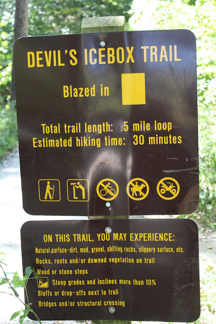
This trail system is made up of four "sub" trails (for lack of a better term). I put a link to the trail map at the end of this post so you can see what I mean. The first one is called Power Line trail because, you guessed it, it runs right under power lines (there's actually a power plant close by).

Below is one of the bike skill areas. A board walk of varying widths.

I was nervous about the trail at first, because it was very narrow and overgrown and well, those kinds of trails make me slightly claustrophobic.

But soon enough, it opened up to this beautiful trail. The first part of the trail has an incline, but it's really not too steep.

This is one of my favorite pictures of the whole day. Scroll down to see what it was they saw.

There he is. Sorry about all the unwanted attention Mr. Lizard.

Another bike skills area. We had fun on this one. It's like a teeter totter but you ride your bike over it. We just tried to see how fast we could run over it.

And then onto the Donjo Trail.

One would think that with as much as we've hiked, that all the woods would start to look the same. It's incredible though how different they all are. Each woods we hike has its own personality, and its own life. It never ceases to amaze me how different they all are.
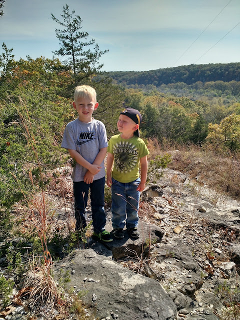
The Donjo Path had lots of rocky areas making up the path. Just another reminder of the rocky bluffs surrounding us.
The Donjo Path had lots of rocky areas making up the path. Just another reminder of the rocky bluffs surrounding us.


And then the Strip Mine Loop which takes you to another scenic lookout.


Sigh...

We stopped to photograph some woodsy flowers along the way.

I've never seen these before. Does anyone know what they are?

And more of the views.


We came across this area with some pretty big boulders and there was just something about the lighting and the trees that reminded me of an old Star Trek episode with the ridiculously unbelievable set decorations. It was really kind of cool.


And then to another part of the woods that a totally magical feel to it.

And then finally the Donkey Kong loop, which is the final loop of the trail. And sadly we did not hike it. We could have stayed at the park the rest of the day, but we had a 2 hour drive back home and both Lex and Jeremy had evening plans that we needed to be back for. We were bummed that we couldn't finish out this hike, but I'm sure we'll return to make things right.

So back down the trail we went, stopping to explore a little more. We saw a few more lizards, a tiny baby frog and a black snake. Yuck. We are constantly on the lookout for snakes, but Eli stepped right over this one before I noticed it on the path. Thankfully the little guy turned himself around and cleared up the path for us. Whew!

Another day, another hiking adventure. The whole hike without the Donkey Kong loop came out to exactly 2 miles.
Some things to note:
Elevation - Moderate climb at the beginning of the hike, and then it levels out.
Terrain - Lots of tree roots and rocky terrain make this a pretty uneven trail in general
Trail quality - Very clean trail, but there are some washout areas that look like they could become dangerous in the future. yikes.
Views - You can get a glimpse of the view through the trees on the Power Line section of the trail, but the real views come on the Strip Mine portion of the trail.
This park also has a camp grounds and from what we saw, the tent sites are really nice. So maybe next time...
Here are the links to both the trail map and the park map. They didn't have any set out in the map holders when we were there, so it might be best to print yourself a copy if you go.
Trail Map, pdf
Park Map, pdf
Until next time!


Comments
Post a Comment